

Guides
Small books with strip maps alongside a detailed description of the route, with well-chosen photographs. They have 2 inches to 1 mile maps.
Pearson's Canal Companions
Very colourful, with clear maps, beautiful photographs and an engaging and amusing narrative. Card cover.
Leeds & Liverpool & West Yorkshire Canals (2017)
- eastwards from Sowerby Bridge to Selby & Goole; round to Leeds plus the whole Leeds & Liverpool with branches; Selby Canal. 112pp
£15.50
Nicholson Ordnance Survey Guides
 The
maps are genuine OS ones and point
north. The text is detailed,
informative and well illustrated.
Spiral binder with card covers.
The
maps are genuine OS ones and point
north. The text is detailed,
informative and well illustrated.
Spiral binder with card covers.
5 North West & The Pennines (2023)
Nearly all our routes: Aire & Calder Navigation (Leeds to Wakefield); Calder & Hebble Navigation; Rochdale Canal; Huddersfield Broad and Narrow Canals; Leeds & Liverpool Canal; Ashton Canal; Peak Forest Canal; Macclesfield Canal; Trent & Mersey Canal (Hardings Wood to Dutton); Bridgewater Canal; Lancaster Canal 208pp
£20.50
6 Nottingham, York & the North East (2021)
- further east and south to York, Sheffield, Goole, Nottingham etc.: Aire & Calder Navigation from Castleford; Selby Canal; River Ouse, River Ure and Ripon Canal; South Yorkshire Navigation; River Derwent and Pocklington Canal; Chesterfield Canal; River Trent; Fossdyke & Witham Navigations. 176pp
£20.50
Videos
South Pennine Ring
Video showing a journey round the South Pennine Ring
£12.95
Leeds & Liverpool Canal
Video showing a journey across the Leeds & Liverpool
£12.95
Cheshire Ring
Video showing a journey round the Cheshire Ring
£12.95
Maps
These are what they say, so give a good overall feel for a route. They are not too big to handle.
Waterway Routes
 Real
maps with the waterway superimposed.
Locks, boatyards and navigational
info are shown. The maps give
lock/mile counts and cruising times.
There is no descriptive text.
Available in two formats: to view
and print; or to use as an app so
that your device's GPS always puts
you on the map.
Real
maps with the waterway superimposed.
Locks, boatyards and navigational
info are shown. The maps give
lock/mile counts and cruising times.
There is no descriptive text.
Available in two formats: to view
and print; or to use as an app so
that your device's GPS always puts
you on the map.
You can choose
from versions which cover 7 or 14
day holidays from Sowerby Bridge; or
journeys on the Leeds & Liverpool.
Buy direct from
Waterway Routes using the links
below.
Handheld
Download the map onto your smartphone or tablet. GPS moves the map as you travel. This works well on a phone, and is stunning on a tablet. Works on Windows computers, Android and iPhones/iPads (does not yet work on Windows phones and Apple computers). Needs MemoryMap to be loaded first (free 30 day trial; full licence £15.00; frequent discounts).
£6.00
£10.00
£10.40
£8.80
View on screen or print out before
your holiday. 35 A4 pp (7 day) or
79pp (14 day). Scale 3 inches to 1
mile when printed A4; 2 inches to 1
mile A5; variable on device.
£9.60
£16.00
£6.50
£5.50
Heron Maps
 Approx.
1:50,000 (1¼" to 1 mile), full colour and
with a lot of informative text and
pictures, plus town centre plans.
Approx.
1:50,000 (1¼" to 1 mile), full colour and
with a lot of informative text and
pictures, plus town centre plans.
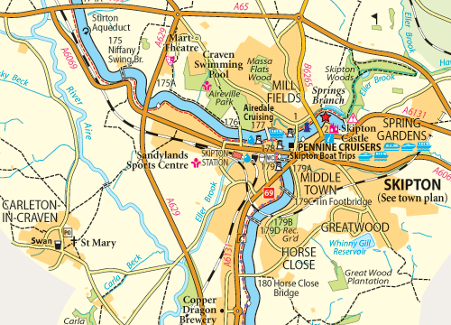
Leeds & Liverpool Canal - Foulridge to Leeds
and Aire & Calder and Calder & Hebble Navigations (2014)
Everything between Sowerby Bridge and Barnoldswick, plus A&CN to Knottingley
£8.15
Leeds & Liverpool Canal - Liverpool to Keighley (2014)
The L&L west of Keighley
£7.15
Imray
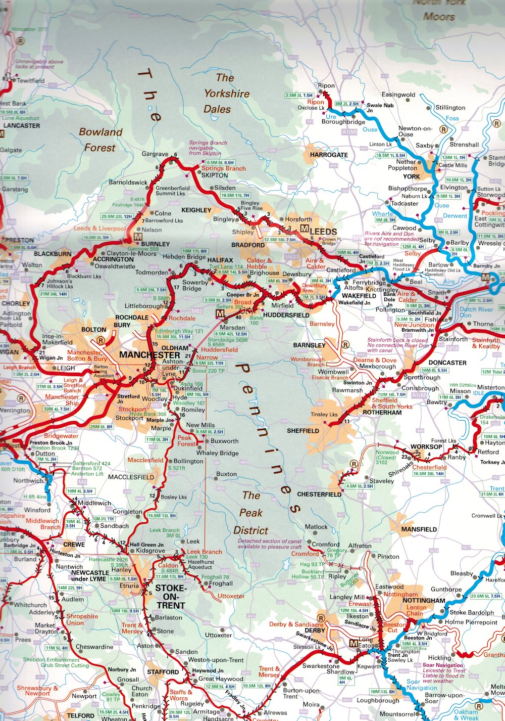 Large
scale map of the whole waterways
system.
Large
scale map of the whole waterways
system.
Map of the Inland Waterways of Great Britain
Scale 1:625,000 (10 miles to 1 inch)
£14.50
Nicholson
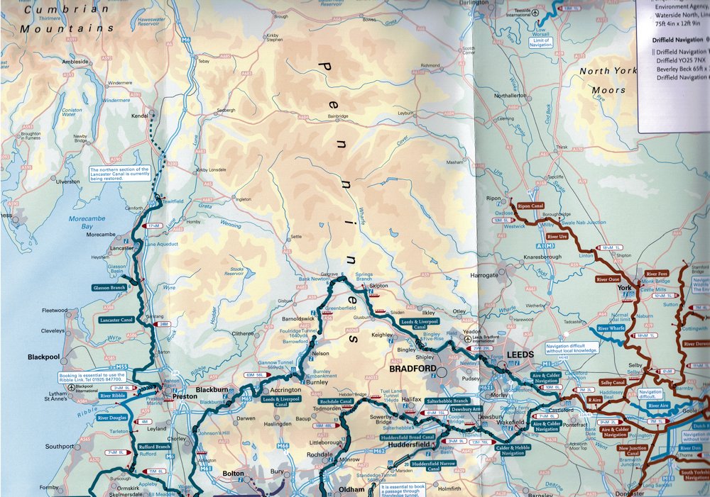 Large
scale map of the whole waterways
system
Large
scale map of the whole waterways
system
Inland Waterways Map of Great Britain
Scale 1:550,000 (8.64 miles to 1 inch)
£12.50
-->